On day 2 we had a choice -go to the Aran islands or stay with the bus.
We decided to stay with the bus as the weather had been fairly changeable and a boat ride there and back is the only way to get there. Also the Aran Islands are a very exposed place. The Americans went to the islands -and the other 4 of us stayed with the bus.
After a sumptuous breakfast we waved goodbye to the castle hotel. The hotel was close to the town of Clifden-made famous by Marconi's work and relay station, and because it was the end of the first transatlantic flight made by Alcock and Brown (16 hours in an open cockpit).
We drove for about an hour through the Connemara region to drop them off to the ferry. They were heading for the smallest of the islands (less touristy)
The Aran Island people have a special type of boat - made from canvas stretched over a wooden framework. This is lighter to carry away from the water.their emblem shows three men carrying the boat.

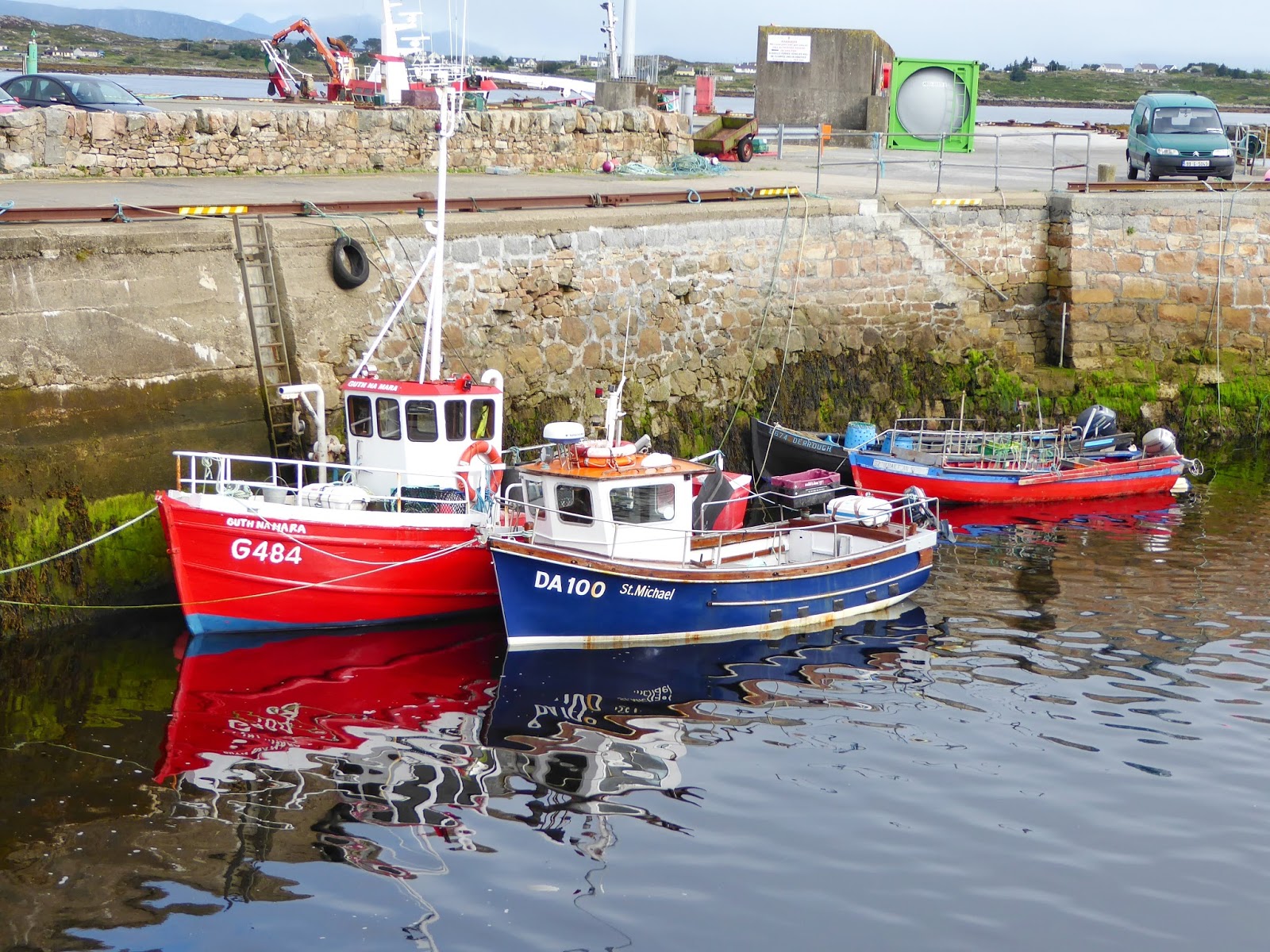 |
| Boats in the sheltered harbour that the ferry left from. |
We've heard lots of stories of famous people from Sean. The feared O'Flahertys who terrorized Dublin folk and were excluded from the city, the rich and gruesome Lynches-who beheaded a young boy after drowning him to teach his parents to pay the rent, Grace O'Malley the noble woman who wanted to be a sailor like her dad, Richard Martin ( known as humanity Dick) who championed animals rights in Scotland, and, of course, Molly Malone (who wheeled her wheelbarrow in Dublin)
Sean has been great at explaining the Irish language - Bally means village, Connemara means sons of Con of the sea, burren means stoney place.
We drove past quite a bit of gorse - which is an invasive weed which flowers yellow twice a year. The farmers pour diesel on the gorse and light it up to try to control it. We've also seen a lot of rhododendrons gone wild which are a big problem in some areas. They get huge and block out the usual plants.
There is a wonderful seaside road route called the wild Atlantic way which we are following a lot. This winds around the roads closest to the sea and has special road signs like an extended w.
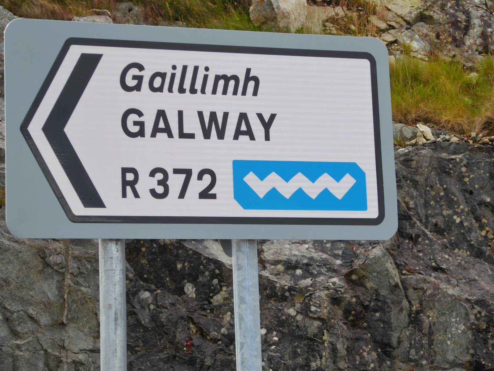
Through Ireland there are areas where Irish language is spoken as the first language. the residents get special grants for this. the regions are called Gaeltech. There are signs marking these areas and spot checks are done. Kids also go to these areas for summer camps to learn to speak Irish and to have fun.
 |
| Irish language sign |
There are a good number of "travellers" (gypsies) parked off of the road. Apparently there are about 200,000 of them across Ireland. Usually they have a lot of freckles. There are height restrictions across the entrances to the car parks so that the gypsies can't get into them and make themselves at home.
We stopped at a 12th century cistercian monastery - built in a very deserted spot it was huge. as with the St Nicholas church in Galway there were gravestones used for the floor in places. Beautiful carvings on the high ceiling area.and some very well kept graves,. Apparently Coner O'Brien killed a number of the architects and masons who worked on the building because it was so perfect that he didn't want it replicated!!!

We had a bit of driving though very narrow lane ways (just room for the bus plus a bike) to get to Cahermacnaughton ( an old fort used as an ancient school for law). The Irish farmer has built his house right up to the side of the fort.
Then on to Poulabrone Dolmen -thought to be built about 500 BC (in the new stone age) where an ancient tomb has been left by the new stone age people They used the limestone caste terrain which naturally formed caverns, and used a cavern as a burial site. At least 30 bodies have been found in this one. Standing over the top is an imposing shelter made from 2 large vertical stones, with one horizontal balancing on top. On the way to this we passed a lovely quiet cemetery on a small hill surrounded by green and granite cliffs, with a tiny track running past. We also passed a cement slipway type of structure. Because the rain soaks into the limestone ground so fast they need to do this to collect water, which then runs down into the trough below to provide water for the stock.

We then headed off to pick up the island visitors from their ferry coming back from the smallest of the Aran islands. Had to wait a while, which gave some time for rock hopping and watching some good surf waves.
As the weather was just about perfect, we grabbed the opportunity to visit the cliffs of Moher (something we originally had planned to do the following day). Very dramatic cliff scenery. The cliffs are about 214m high. You can see the Aran islands and Galway Bay from the top.
 |
| The castle looking thing on top is a watchtower. You could see possible invaders from here and send a signal. That is the Aran Islands on the horizon |
No comments:
Post a Comment