Sunday 25 October 2015

Heading home from Ballarat-day 3


I left off as we crawled in to our warm swags at Mt Monster on Tuesday night. Now the saga continues....

Wednesday dawned and we woke to find a beautiful day awaiting us.  Tonight we were half expected for our regular Wednesday night dinner date with friends. Would we be there, or would we find so many places to stop that we would be camping somewhere for another night?

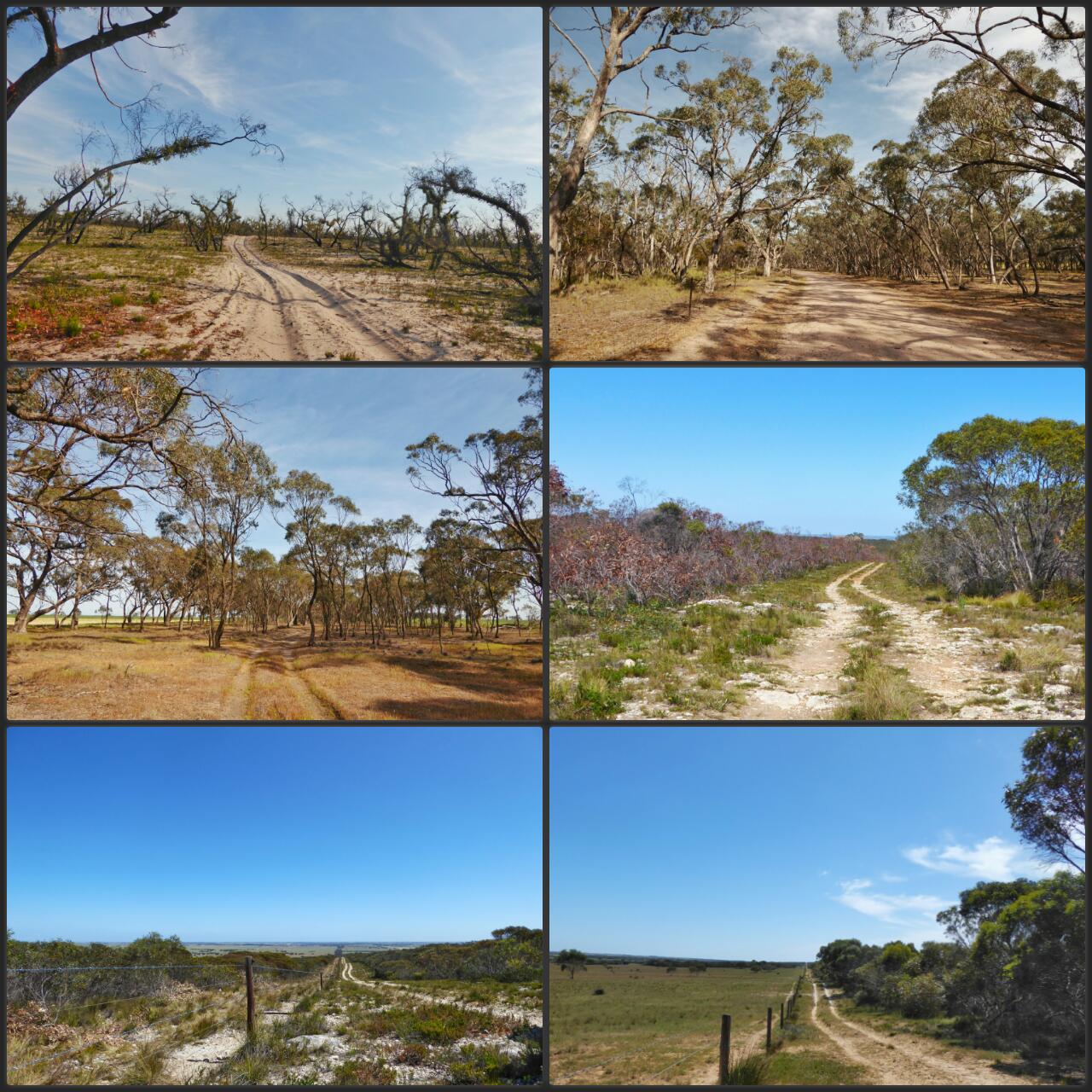
Mount Monster offers a couple of geocaches to find and also a signposted loop walk. We took a walk brochure from the box, dusted off the spider, and headed off to admire the views, and learn about the local flora and the people who donated this area to be a park.


The walk was easy and the information was interesting as we followed from post to post. We saw a few pretty flowers on the way. 


 The summit has a trig point (note the unusual animal that I found there) and a bit of a view over the local area. The warm reds of granite give way to the olives and browns of the natural bush within the park, and then to the greens and browns of the surrounding plateau.  Also an extraordinary collection of roo poo.  The roos must find these large granite rocks a nice warm spot to sun themselves I think.


Reluctantly we went on our way, finding a large quarry area also within the park as we drove out, and some other potential camping spots too (though not so formally marked). 

Since we were so close to Keith we headed there, enjoyed a free cuppa at the local bakery and bought the newspaper. Can't go without that cryptic crossword much longer.  Now we could head down the highway and be home in a couple of hours or.....

We could go adventuring a bit more.  
Next spot was a revisit to Tolmer Rocks via Tintinara. These rocks, like Mount Monster, bulge unexpectedly from the flat landscape around them.  There is a track that curves around the bottom of the rocks which has some nice flat areas suitable for bush camping.  As long as it is not a fire ban this appears to be allowed. A few friends could easily find enough space to park their vehicles here and enjoy the serenity.


The day was warming up and the reptiles were enjoying the sunshine. In the next space of driving we saw numerous lizards and a couple of brown snakes.


We headed towards Mt Boothby Conservation Park and took the rough track through a small section of the park and around the edge. Although only a short distance this took a very long time due to the very rough track, which required a lot of slow and careful driving. A lot of fire damage was evident in the park, and also many emus, which decided to run on the track in front of us in a seeming mad panic, rather than staying quietly in the bush.  As we took the track around the perimeter we stopped on the rise to admire the view and have a cuppa, before taking the clearer track along the western side. The crazy emus enjoying the cleared paddock on the other side suddenly decided that they needed to get into the park and ran along the fence line, crashing in to the fence over and over until they made it through,  and then running across the track in front of us.  Crazy animals with very little brain! No wonder the poor farmers keep on having to fix fences. Those birds are very large and sure must hit the fences with a lot of force when they do that.

The north western corner of the park offered some flat areas which might  be quite good camping spots, but it's a bit tricky to get to. We left the park via Richardson Rd, but that road might get a bit messy in the wet.  It might be much easier to get in via Lutze Rd to the North. We haven't tried that though, so not sure what it would be like.  We've also realised that the nearby Boothby rocks reserve, a few km down the road to the south,  may also have some good camping and we've never been there, so next time we are down that way we will need to check that out too.

We meandered our way in a vaguely northerly direction, finding ourselves travelling across some very 4WD track (soft sand) along the old gold route. I hate to think what it would have been like in the old days. In various spots along the old route there are memorial stones.


As we reached the start of the Crows Nest Rd Trevor remembered that there used to be a cache in this area.  Sure enough, with the limited mobile phone coverage I had we identified that it was still there.  It has been a long time since we completed a multi cache.  This one used the information on the stone.  We had to use the actual GPS -which meant finding it and waiting for it to lock in on some satellites.  Eventually we drove back over some of the deep sand and traipsed through the bush to find the cache, then turned around again and made our way on towards home.

As we worked our way towards our junction with the Princes highway we came across Mason's Lookout Rd.  Thinking to find a lovely lookout we followed the road, but couldn't find the lookout.  Eventually eagle eyes Trevor noticed the gate into a paddock with the sign "Mason's Lookout". We couldn't even pick out a track across the crop.  It doesn't look like the lookout gets many visits, and we left it that way. Somewhere up in those sandhills is a lookout.


Once we hit the highway we were nearly at Tailem Bend and home was calling, so we stayed on the highway and were back in our own house a little over an hour later.

Thus ended a very enjoyable few days of relaxed travel on the back roads, and discovery of so many lovely places we would usually drive straight past.  Hopefully it won't be too long before we have the opportunity to do it again, and maybe to use some of those newly found camping spots.


Saturday 24 October 2015

Roads less travelled between Ballarat and Adelaide in early October 2016

As we travelled we marvelled at the changes in the countryside.

We took some photos on the way and here is a brief snapshot of some of the roads we took.


Heading home from Ballarat the slow way-day 2 (October 6th)

The journey continues to bring us home from the National orienteering championships in Ballarat.

We pick up the story at our campsite in Little Desert National Park very early in the morning.  We were in our swags , so once the sun was up, we were...pretty nearly anyway.

Having enjoyed the blue light of dawn and a very balmy night, we hauled ourselves out of our comfy swags and made a sumptuous breakfast, using up many of our veggies in preparation for the border crossing back into SA.
Due to the quarantine for fruit fly between SA and other states all fruit and vegetable needs to be eaten or dumped before you cross the border back in to our home state. This has helped to build the South Australian tradition of "eating fruit at the border" which many of us enjoy on our road trips between states.

We enjoyed our eggs and bacon with avocado and stack of yummy little tomatoes, washed down with orange juice and a lovely cup of tea as we enjoyed the sounds of the bush and the unhurried feeling of not needing to be anywhere at any particular time.  Maybe we would be home today, maybe not.

Sadly, we had completely forgotten that there was a geocache at the waterhole, and we left without searching for it...worse still, we found out later that my friend Kaye had recently left a path tag there, which I could have found ... oh well.

We bumped and ploughed our way out from the campsite across varying areas of deep sandy track, and hard clay which must be a challenge in the wet. Deciding to leave by a different route, we headed out the Miram South road via the inappropriately named McDonald Highway (it is more a track than a highway)  and Broughton's track.


Towards the northern borders of the park there was very obvious fire damage, with some areas showing very little undergrowth and a large number of blackened trees. Others showed the very clear signs that their epicormic buds had been hard at work-with the green "fluff" long their trunks and branches supplying them with nutrients as they work to survive in that amazing way that eucalypyts have.


Sadly the crops along this track were also struggling, showing that the West Wimmera region has really struggled this year. We saw some crops already being cut for hay as we drove towards Serviceton.


We lessened our chances of making it home by deciding to take the opportunity and catch up again with cousin Judith on the farm . Of course the back road was more attractive,  and we chose to take the little used Three Chain Rd to the left before we made it to the main highway.


This might be a bit tricky in the wet (particularly the bit which doesn't even show on the map) but in the current dry conditions it was not a problem, and revealed many nice spots which would be potential emergency pull off spots to camp for the night should the need arise at any time.


A few hours later we had offloaded our remaining fruit and veg, seen the new lambs, the ducks and chooks,  patted the cat, fed the dogs and let them out for a run, hada cuppa with Judith, and visited Millie and Annabel just a km or so down the road. (first visit to see the sleeping Annabel. Great to see Millie in the mum role.)

We headed off again and stopped about 2 km further along at the local roadside stop to read the local information ( if you are interested in reading about the contested territory between Vic and SA this is the place to go) and have a bite of lunch before heading onwards.  Now we were resorting to cans of tuna and biscuits for our food.

Only half an hour or so and we arrived at Bordertown-nestled in beside the noisy Dukes highway and agreed on a return visit to see Uncle Barry and Auntie Bett. They have been very special people in our lives, and we were pretty worried about them when we saw them on the way over, so it was great to have time to drop in again.
We found them having a nap while their newly arranged cleaner worked in the kitchen. This gave a lovely chance to sit and chin wag, for Trev to adjust their air conditioner,  and for them to bring us up to date on all the family news.
A couple of hours later, as we left the warmth of their home and company Trev was able to assist by unlocking the car which was "stuck" out the front due to flat battery and locked doors. As always a trip to see these two was a treat for us. They are such loving and non-judgemental people.

We were, by now really in the mood to "Bummel" as our friend Regina calls it. (I believe that this is a German word which means to take a journey with no specific destination or end).
We decided to take some more back roads and to vaguely start looking for a place to camp for the night.


First stop was Poocher Swamp (a lovely open area on the Canawiggara Rd, near Mundulla with some deep water holes which are currently dry) Here we found a padlock on the gate, but the lock was not locked.  A little unsure what this meant, we drove in, and followed a track around the area, passing a mob of grazing sheep who seemed a little confused by our presence. Large old gums shaded lovely flat , grassy areas over a huge expanse, and there were plenty of possible camping spots, but feeling a little uneasy about the legality of our presence we decided to press onwards.  Looking at the satellite map later it is clear that those wide grassy areas are sometimes under water -allowing for a thriving game reserve in the right conditions.

Further along the same road we discovered Aberdour Conservation Park.  Finally finding a rough track in to the park at the very last (south western) corner we ventured in a little way, but it was clear that there was not going to be a spot conducive to happy camping here. A lot of prickly bush, and rough sloping rock was offering an uncomfortable option so we continued on our way.

Now we were starting to consider returning to the Mount Rescue Conservation Park (the south Western corner of Ngarkat) but we had one more option to check out.

Mt Monster Conservation Park showed as a small spot on the RAA map, but it was pretty well on our way, so we decided to detour a few more km and check it out.  On the way we passed a large Lucerne growing area with what appeared to be flood irrigation (much to our surprise given that this is the driest state in the driest continent.)

We were delighted to find a well made track curving in to the park, and the welcome sight of some flat camping areas , bordered by permanent pine rails and  posts which gave the impression that camping was welcome. We cheerfully took up the unspoken offer of a home for the night, pitching our swags near a handy table beside a huge eucalypt. The fact that there were no facilities wasn't a problem for us, given that we had the place to ourselves.

Mt Monster is not a big mountain (more of a hill) but it is an unexpected outcrop in the flat plains of the local area. We would love to know how it got its name. I do know that the sunset was just spectacular seen through the surrounding bush


And that our remaining scotch and coke went down rather well with the reheated chicken curry and rice which was pretty much the only food we still had on board.

In stark contrast to the night before , we were huddled in our coats and beanies as we prepared to snuggle into our swags, listening to the distant sounds of the traffic on the highway, and once more enjoying the isolation of camping along a road less travelled.

Thursday 8 October 2015

What happens after the party is over?- heading home...the slow way. Day 1-Monday October 5th 2015

Since we are still on long service leave- and simply because we can- we took the opportunity not to rush, but to wend our way home on the roads less travelled (as we love to do when we can).

Having said goodbye to Adrian an hour or so earlier, we finally left Harrowfield on the dot of 10 am.   First stop the local service station to add $180.00 worth of diesel fuel to our tanks. Not bad considering the fact that we hadn't filled up since before leaving home.

Over the entire ten days in Ballarat we had not had a good look at the lake , so we thought that since we were now in meandering tourist mode we would do a circuit and take a look. A few years ago when we visited here the lake was dry but today we were not disappointed. It looked glorious on this beautiful spring day.  Lots of people walking the path around the lake, the coffee shops doing a roaring trade with alfresco being the order of the day as the balmy sunshine filtered down. The water was right up to the height of the boatsheds. We spotted a strange machine out on the lake and figured it was a trash collector. It seemed to be driving across the lake, stirring up water and pushing it through a filter to pick up rubbish.(Kay has since told me that this is, in fact, a weed cutter-which drives across the lake-thanks Kay)


Our next stop was the botanical gardens where we enjoyed the poppies and tulips, the sculptures in marble, the camellias and the sculpture walk edged with bronze busts of each Australian Prime Minister.The last two are missing at the moment.


Julia Gillard
We drove out through the wonderful avenue of honour-an impressive memorial to the Australian  servicemen and women. 

This was the first of many different road views on the day. 


It was a warm day (38 degrees C) , but it didn't matter as we drove in air conditioned comfort and didn't notice it unless we were out of the car.

We were thinking to stop at the lookout at Ararat for a cuppa, but the hot north wind reminded us of another time when the wind at the top there grabbed the door on the landcruiser and caused damage, so we opted to stop by Green Hill Lake on the way into town instead.   This is one of the lakes looking dry at the moment-with only a large puddle in a grey mud basin -not so picturesque. I do love having the ability to just pull over when we feel like it and have food available from the fridge and drawer in the back  and hot water for a cuppa from the thermos. The cache nearby made up for the view, but the family news by phone of an emergency dash to Perth for Ross put a bit of a dampener on the day.

From here we decided to make our way to the Grampians via a road we had travelled less often.


Driving into Halls Gap always feels great-with the craggy rocks of the Grampians towering over you as you enter the township. It was busy there, and all the tourists were trying to find a bit of shade to eat their lunch, so we sat in a rotunda and chatted to a walker who had just completed two days of trekking in the Grampians while we shared his shade and ate our bakery treats.

A quick loo stop to the  public toilets revealed an unexpected and enjoyable bit of local art in the form of a sheltering divider on the outside of the decking surrounding the building.   All etched out of thick steel, with the light from  behind forming the picture against the rusted metal background. I enjoyed these panels greatly.


We then headed out of Halls Gap, taking the road that cuts across the North of the Grampians (Victory Rd). This is a winding road which offers wonderful glimpses of steep rocky slopes and thick forest. The roads leading to many popular Grampian walks and lookouts turn off of this road and we couldn't resist detouring to the Boroka lookout for great views back over Halls Gap.


Once we left the lookout we were tempted into taking a little track which showed on the map (off to the right) . And boy was this a treat!!!! This area has been fire damaged to an extreme extent and is now coming back . As we drove we marvelled at the ability of the bush to regenerate and enjoyed the beautiful colours of the young leaves in the sunshine.


As we came close to Smith's Mill campground we came across a little stream cascading over a tiny spillway as it gurgled along. A small grassy patch was so inviting that we pulled in and made ourselves a cuppa, reclining on the grass beside the stream and marveling at the new growth and clear water.


Smiths Mill Campground is actually pretty cool. We stopped to use the loos and discovered that there is also a bucket shower (with rose attached) .

 The shower is the small building to the right of the toilet block.
This pic does not show the chain used to lower and raise the bucket to enable easy filling.
A short deviation to Lake Wartook allowed us to admire more distant views and reflections


before we headed onwards, past the magnificent views of drops down to the MacKenzie River (easier at the moment to see the sandy winding path many metres below due to less vegetation in the way) , past the fire damaged Zumsteins (I wonder how the tame roos managed in the fire?) -And finally wound our way  out at the other side of the park on to the flat Victorian plains.

From here we zigzagged our way via some back roads and some back tracks to the Little Desert National Park,


where we drove in over about 8 km of very sandy track to Broughton Waterhole-Here we found one family camping.  We set up across the waterhole from them -throwing out our swags behind the low bushes, but still having a view of the roos coming to drink at the waterhole from our folding chairs as we lounged in a stiff north breeze with our drinks in hand waiting for the sun to set.

Photos of the sunset reflections in the waterhole and reheated  leftovers made for an easy life, and we sat discussing life, the universe, and everything and enjoying this extra escape night in the bush, before falling into our swags to enjoy the star show from a horizontal position.  Because it was so warm I could be comfy with just mesh zipped on my swag to keep the bugs away, but this gave me a wonderful view of the night sky each time I woke, of the sliver of moon,  and then of the beautiful dawn colours as day began again.

Tiny plants growing in the Crack in an old picnic table

Bees having a drink at the waterhole

Sunset

Dawn (from my swag)
That's enough of the tale for today.  There are things at home that need to be done.
Tomorrow I will aim to tell the tale of day 2 on the way home. For now,  I'm signing out.

Sunday 4 October 2015

Australian Relays

Today we had the state relays.

SA did Ok , with our W16 girls, M12 and M16 teams on the podium.  M21AS also won, and we had a mixed team and M65 also in the places.
It was another long hard day with warm weather and tough courses.
Results were a bit tricky with the relay software and don't appear to be up online yet.
Trevor ran a longer course than usual, pretending that he is still 45 years old, and I also  ran in the W45.  As usual Trevor ran better than I did on a longer course,  but we were both well outclassed by others who can push through bush as though it isn't there and run up and down hills endlessly. After yesterday's courses today was just a bit too much, with step gullies and quite poor visibility.

It is always fun, however to run in the relays.  The excitement of being a part of a team  representing the state and the camaraderie is terrific.   I particularly enjoyed my team mates Susan and Jill this year who came into the relays with the attitude that we were all there to do our best, have fun and enjoy it. And we did.

I went out first runner, so there are no photos of early runners, but I have a few of those who came along in the later part of the day.

My two fabulous team mates:


Meredith

John

Peter
This one was taken waiting formthe second mass start to leave the arena. Note the good looking bloke in the foreground.

It has been great fun, but now it is over for another year, and us SA people start to think about 2018 and how we can supply a carnival of this calibre for the Aussie orienteering fraternity. 


Saturday 3 October 2015

Aussie champs sprint and long distance.

Today's event-looking back  the finish chute (to the right of the red and white tape) to the last control.

The Sprints were held yesterday at St Patrick's college in Ballarat. Centreing around an oval they offered something I've never been a part of before-a map exchange! This meant that runners on six of the courses needed to run on to the oval, punch a control, throw their map into a bin, then pick up a new map for their course and continue back into the school buildings for another frolic.
The sprints always fast and fun, with many fast direction changes.  This one certainly didn't disappoint.  You had to keep your mind sharp the whole time. I forgot to turn mine on before I started and lost about 35 seconds on that first control by not knowing where north was. A bit of a pain, but I was really pleased that I then managed to keep my concentration until the third to last control when I got rattled  by the fact that I didn't hear the beeps at the control,  waited for four people to do their punches (their was only one punch)and then did my own again (only to find that it was just a very quiet one ), and proceeded to head for my last control instead of my second to last! Luckily I checked the number, saw that it wasn't right , and realised my mistake. Then I had to slog back across to the goal post control and then turn around again, all the time with Andrea from Tassie screaming in to the finish (and I knew she had started after me).  We enjoyed a tough battle up the finish chute and a puffing laugh afterwards over it.

This is what my maps looked like.


The highlight was that Olivia won the W17-20E course .
Other results can be found at


Today was the long distance event.  
It was very long and hard. By the time I stumbled down the finish chute 1 hr and 40 minutes after I started I was totally spent. Possibly more tired than I have ever been at the end of an event.
It was a hot day and this really took its toll. My legs didn't have much in them today either, so I was pretty happy to end up 19th of 26 runners.

Trev had a much better time of it -coming 4th in the M 45 AS class. By the time I arrived back he looked fresh as a daisy. 

Other results for today can be found at


Whole map

My legs from 8-9 was my worst leg with 9-10 following closely. Both of these were tough navigationally after a physically tiring course, so the brain really wasn't working well. 


Coming across towards control 9 I crossed the road just to the left of the straight line,crossing the small  ditch that ran parallel to the road. Continuing over the hill
I must have deviated a little more to the left and arrived at the thicket to the left of the one I was looking for and used it for an attack point. Bad idea when it is the wrong thicket! Needless to say I searched around in there for a while and finally relocated off of the deep erosion gullies to find it. I probably lost 6 or so minutes here.

I had limited time for taking photos today. Just a few of the early finishers that I happened to be able to snap.  We had a finish chute coming down the side of the paddock which was being used for the assembly area and skirting along the bottom of it under a big screen. 


Some of the SA contingent