Tuesday, 7 June 2016

Hooray for WA Day 17 Start of the Old Eyre Highway in from Border Village to Scott Point


We had a later start due to the time change.

We travelled the length of the the Old Eyre Highway between our campsite just past Border Village to Nullarbor.


We stopped for morning tea at Koonalda Homestead (flavored tuna and lettuce on vita weets) and had a look around with Joc, then continued on and had our lunch by the old tank where we camped on the way over.


Just a short distance on from Nullarbor we turned in towards the head of the bight and were excited to see that the sign on the entrance showed 10 whales had been seen today! We were happy to pay our entrance fee to access the viewing platforms so that we could see the view along the cliffs to the west and the sand hills and white beaches to the east as well as the whales. It's hard to know how many whales we saw - maybe half a dozen- but we definitely saw large and small together (we assumed mother and calf) as well as other large whales. Mostly they were under the water, but sometimes they seemed to lay on the surface of the water and just cruise along.


Eventually we thought we had better get on our way. We headed for Fowlers Bay, finding a bush beach campsite indicated close to there in our campsite book. unfortunately all we knew was that the turn off was off of the Coorabie to Fowlers Bay road, but there was no signage, so we made it all the way in to Fowlers Bay in the darkening gloom, not finding the campsite. Luckily when we got there we found public toilets for a comfort stop and also a enough phone coverage to use our camped app, and find some coordinates for the campsite. Then we backtracked 13 km to the correct turnoff and guessed the track in from there, enduring the worst corrugations of the holiday in the process. Eventually we found a small bush camping site with already one an and one tent already setup in a sandy basin between sandhills.

The sliver of moon was already going down so we had a magnificent starry night sleeping to the sound of the waves on the beach on the other side of the hills.... Just about perfect.


Monday, 6 June 2016

Hooray for WA Day 15 Forrestania Plots to somewhere past Norseman

Hooray for WA

Day 15

Forrestania Plots to somewhere past Norseman

The rain had fallen lightly overnight, but came down more as we finished off our eggs and bacon and realised that our gas bottle was pretty much empty.

By the time we were trying to get swags on top and ready to go it was harder, and poor Trev ended up tying them on really well so we had no flapping, but also getting quite damp.

The road between Hyden and Norseman is a special "Granite and Woodlands discovery trail "due to the many species along the road, and it was actually a great treat to drive along, noticing the differences in vegetation due to differing soil types as we went. This would be fantastic in wildflower season particularly.
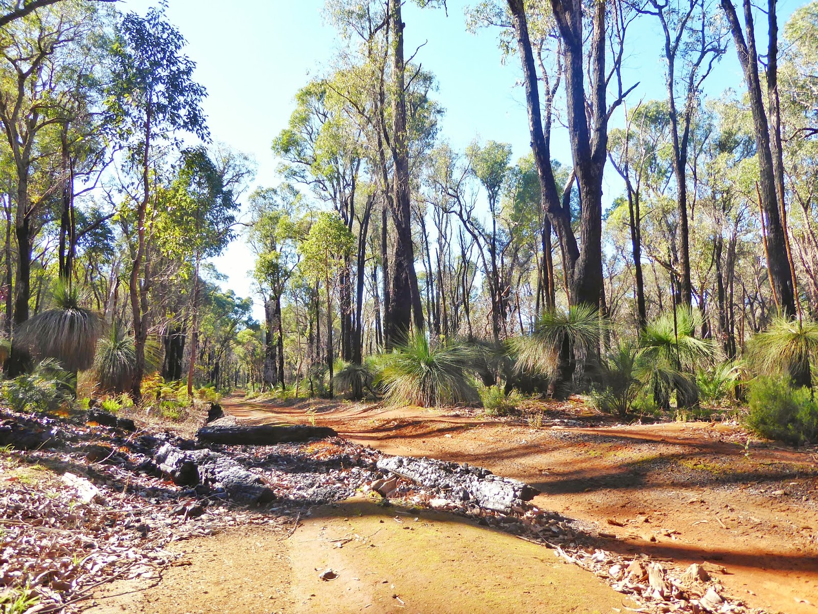
Along the trail we could pull off and read the notes about that spot. These gave great insight in to the area, which contains a large amount of land which has never been farmed due to lack of ready water. There were more amazing rocks, the breakaways, rare eucalypyts, heath lands, salmon gums, salt lakes, and an agate gem deposit where you could fossick if you wished.

We all particularly enjoyed a walk on McDermid Rock, a granite formation with lots of interesting rock pools, cracks, colours, suspended boulders and other features which were explained in a really entertaining fashion on the 18 information boards dotted along the walk path. This would have been a fantastic place to camp.

These puddles had tadpoles swimming in them.


The breakaways were interesting to see with the many colours in the rock and the overhangs and formations which have formed here, but it looked like it is a bit too popular as a campsite for us, with about half a dozen campers still there when we arrived mid morning.


Lake Johnston was quite scenic, and there was a walk we didn't have time for. Great Vista with Salmon gums stand on the eastern side.


Disappointment rock had some great flowering trees around and offered another 2km walk on the rock which would have offered similar insights to McDermid, but we didn't have time for that, so we admired and went on. This would also be a great place to camp.


Lake Cohen was near the end of the drive, (with Norseman in sight) and is a huge salt lake. Very impressive.


We stopped to fuel up and fill with gas in Norseman and headed on, but decided about an hour down the road to call it a night, pulling in to a parking area, and following a track back in off of the road to find a nice spot. We planned to have a fire and put up a tarp to protect us from the expected rain tonight. This gave us a chance to erect shelters and collect some wood while it was still light and before rain arrived. The fire also gave us a chance to use our "Suchy"-the wonderful blacksmith's special peg puller and billy lifter that our friend John Such made for us.

By the time we went to bed the grey sky had cleared and the stars were visible.

Hooray for WA Day 16 Just past Norseman to the start of the Old Eyre Highway in from Border Village (680km)

Hooray for WA

Day 16

Just past Norseman to the start of the Old Eyre Highway in from Border Village (680km)

We were lucky overnight, with no rain falling, but another grey day dawned with the sun trying to peek out through the clouds. We were on the road by 8.30am

One of the attractions of this stretch of road was the rock sculptures on the side of the road. Someone (or ones) have spent time building rock piles and dressing them or decorating them with clothing. We had spotted some of these on the way over, and agreed to try and get some photos on the way back. Luckily, the road was not too busy, so it wasn't too difficult to safely back up or do a quick U turn to capture the shots. Luckily we had a very patient driver.


Trevor performed some first aid-replacing the head!


At one stage, as we drove along we saw a dark shape on the road ahead and slowed. As we came closer it became apparent that there was a big brown cow on the road! She was sitting down on the road and had 3 traffic cones placed around her. As we went past she rolled her eyes dolefully at us, and we could see her legs stuck out in strange directions and bloody injuries. Clearly she was not going to be moving under her own steam. We figured that she had probably been hit by a truck, and hoped that the truckie had gone to get some help for the poor cow, who must have been in a lot of pain. There is no photo of this as we all hope to be forgetting this as soon as possible.

5 km out of Caiguna we pulled in to have a quick look at the Blowhole. This is just one of many caves on the Nullarbor which form in the limestone rock. Air travels between the caves as pressures change, and has been measured coming out of one entrance at 72km/hr!


We ate lunch at Cocklebiddy before heading on to enjoy the view of Madura from the lookout (and find a cache) before we continued east along the plains below the escarpment.


We visited the old telegraph station at Eucla, now blanketed in sandhill halfway up the walls, standing quietly as a relic of times gone by.


 We were hoping that this might be a potential camping spot, as it was close to sunset by now, and we prefer to make camp before dark. Unfortunately there was no opportunity to camp here, so we continued on, crossed the border and drove past Border Village. As the dirt track which is actually the Old Eyre Highway left the main highway we followed it.Its hard to believe that this single track used to be the main access between east and west.

A few km on we spotted a small track in the light of our headlights, and followed it into the bush. It opened up into a wide open space. This was our lovely overnight spot. We sat around a warm fire and ate the last of our fresh dinner veggies tossed with left over cooked pasta and sausages with a little spice. Tomorrow we should cross the quarantine checkpoint (just outside Ceduna) , so most of the fresh fruit and veggie will need to be eaten by then.

Saturday, 4 June 2016

Day 14 Perth to Forrestania Plots (Friday 3rd June)


It was been quite a long day, starting at 6.30 for us, and 6.15 for Joc.

We eventually headed out from Perth with a Joc on board at about 9.15


We took our first break at York, when we took Joc up to the lookout to enjoy the view. We had our cuppa for the day and found our first cache for the trip while we admired the memorial trees which are being planted in the area.


We headed on and had read about the Tin Horse highway, so we're keen to see that. Kulin were looking to publicize their annual race meet and came up with the novel idea of building tin horses along the road to the racetrack. This idea has really taken off and there are now over 70 different horses to admire (and take photos of). We took too long taking photos of horses and were very late arriving to see wave rock.


As we walked the path to the Rock itself the sun was setting , so we walked up on to the Rock as it was getting darker, and had a fantastic treat of sunset colours in the sky (better than the sun setting itself).Then we had to come down in even less light and find our way the remaining 50 km or so to our campsite in the dark.


The only scares were an owl and a kangaroo. We avoided them both.

Finally we arrived at our campsite and set up for our first night in the dark (not ideal). It worked fine

Friday, 3 June 2016

WA Day 14 Starting the trip home

We've just left for our trip to SA

Trevor, Joc and Erica ready to go
I'm pretty impressed that we are on the road already at 9.30 am.

Trev and I left Mandurah at about 7.45,  winding our way through the peak hour traffic to pick up Joc. Then we had a bit of a repack, and now have two swags on top to give more space. Today should be good weather, so this should not be a problem (at least for today).

Today we hope to get a little past Wave Rock, (to a spot called Forrestania plots) but this is a loose plan  and anything might happen.
We may not have coverage when we find our spot tonight, so there may  not be a post for a while.

Thursday, 2 June 2016

WA Day 13-History of Mandurah and packing up.

After another sleep in we stepped out into a sunny day and headed out to chase the local history.

We had located a heritage walk route at the tourist information centre and following it turned out to be more of a challenge than expected. We did out best, but still failed to locate some of the spots.  One was a pelican statue  (which we assume has been moved since the walk notes were created), but we are pretty sure that the old ballroom must have been there, and the notes not clear enough to explain the look and location after multiple readings. Oh well.

We spent some time imagining what the bay must have looked like back in the old days, when the caravan park and tent city filled what is now a park area, and a swing bridge went from one side to the other.

We tried to walk down under the bridge to see the old original, but today the boardwalk is closed because of some works they are doing, so that was not to be.


We did locate the very retro garage building (now shops) which used to have all the latest vehicles, and the old tea rooms building.

The original church has been used in a much larger church which is still used today.

The old


The new (attached to the old)


There is also an old piece of wall still standing right next to the post office. This is the last remnant of a migrant barracks. It was built in 1880 to house Japanese fishermen (indentured workers) who supplied fish for the cannery.

Old wall of the migrant barracks

Statue of Japanese fisherman.

That's pretty much all that remains of the historic buildings in the centre of town.

As we went past we took a quick snap of a "bike sculpture" that we thought Kay might enjoy.


 The tour ended up at the front of the local fish and chip shop, which we thought must be a sign,  so we bought our lunch there, and sat down to eat from the paper the old fashioned way in the lovely park area which spreads out along the foreshore.

Shopping had to be done to prepare for the trip home, so we hit the local Woolies before checking the tyres and heading home to repack the car and do our tidying up.

WA Day 12 Captain fawcett 4WD track and catching up with the cousins.

We had another idyllic day today and made pretty good use of it, taking our expected 4WD track drive.

The Captain Fawcett track commemorates one of the early pioneers of the district, Captain Theo Fawcett. He held large amounts of land at Pinjarra but realised that he would need heavier land as well. He also took up land near Marradong (on the other side of the Darling Range), and then displayed remarkable bush skills by making his journey directly home through the bush, blazing his way as he went to show the way for his workers.  His blazed track is now the present road between Marradong and Dwellingup that we drove on today.

The commemorative trail starts quite some distance South East of Dwellingup and runs through an area of the Lane Poole Conservation Reserve. Much of it runs along old rail embankments where the trains once hauled timber, but as we found today, the old trestle  rail bridges which we were looking forward to seeing no longer exist.  No doubt the last bushfire destroyed them.

As we entered the forest track at the start of the trail the signs of bushfire were very evident. New growth of palms and xanthorrea was very green among the dark burned wood. Small bright tufts of bright red and lime green shoots were shining translucent in the sunlight  as we navigated the excellent route directions on our brochure and the large mud holes along the way.


The Murray River ran alongside us for the first 15-20 km of the track, before we turned up into drier  country.


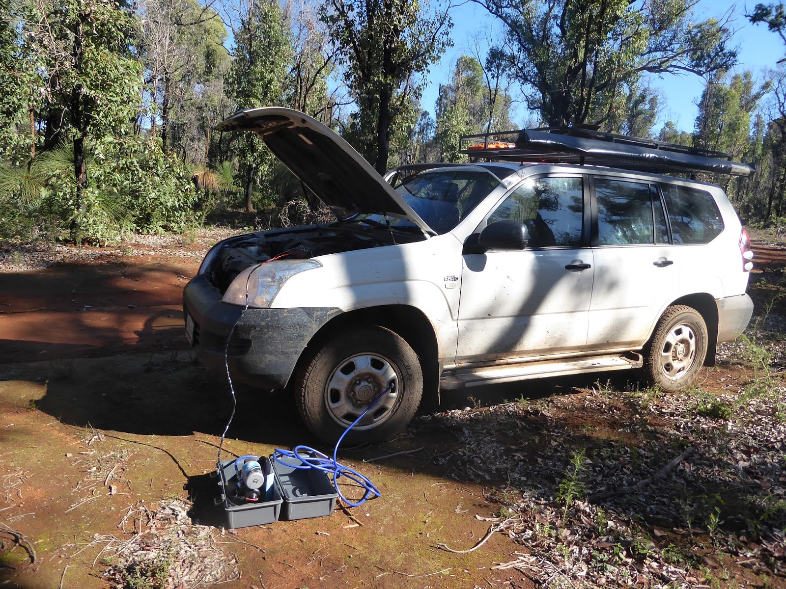
Somewhere in there Trev checked the tyres while I took photos of the impressive grass trees, and found the front left down quite a bit. So we took a brief break and used the compressor to pump it up again.  It went fine after that, so we are not sure about the cause.


 Approximately 40km (and 2 hours) later we turned out of the native bush onto a dirt road which soon became a bitumen road, and decided not to bother with the rest of the route, which appeared to follow the black top for the majority of the way. The track is published as 115km long, but it seems that only this 40km or so stretch (and possibly a little at the end) is actually 4WD. After 1 hr,  and only 20km we had been wondering how on earth the track was going to take us about 3 to 4 hours! The bitumen bit explained that.

We crossed over  the rather interesting conveyor belt carrying produce between the large Huntley Bauxite Mine to the Pinjarra refinery and then crossed back under it a few more km along the road after we had headed back towards home. It is pretty noisy.


On the way towards home we pulled in on a lovely old bush track to have our lunch and then took a short look at the tourist railway station (and sculpture) at Dwellingup.


The late afternoon and evening were passed very happily up in Perth catching up with cousin Tim, cousin John and his good wife Lou, and Aunty Joc, who fussed over us and fed us too much good food. We never have long enough with these rellies, so it was a pity to say goodnight and head back towards Mandurah.

We forgot to get a photo of the relatives,  sorry.