Sunday, 31 July 2016

Day 10 red centre Kings Creek Station to Uluru

Day 10

July 30th

Kings Creek Station to Uluru. -333km

Law nights campsite at Kings Creek Station

Curtin Springs free campground -only 90 km in to Uluru

first views of Uluru

Uluru sunset.


We had a leisurely start to the day without noisy neighbours. We dropped in to catch the latest news from Al and Zita (waiting for oil to be delivered by Audi Roadside Assist) and headed onwards towards Uluru. Virtually at the intersection of the Lassiters Highway and Luritja Highway we pulled in briefly to find another cache and have a cup of tea. Here we watched a three trailer road train offload two of his trailers, and head off in towards Kings Canyon, leaving them behind. them not long after pulling on to Lassiters we found a reasonable looking overnight see topping spot, and then not long after that we stopped for views of Mt Conner (the fool's Uluru, 500 million years old and part of the same rock formation as Uluru and Kate Tjuta) and climbed the red sandhill for a surprise view over Lake Amadeus (a large salt lake). Apparently Mt Conner is horseshoe shaped, although you cannot tell that from the main road. While we were stopped a wedge tailed eagle soared over us , working his way back and forwards, and looking out for a snack below.

We had a brief stop at Curtin Springs for lunch, before heading on in to Yulara. Caught up briefly with Jenny Cas in the reception line at the campground. We were messed around with our booking and ended up in different areas of a very full and noisy campground. We went out to a cafe for tea and booked ourselves in for the field of light in the morning. We had to be waiting for the bus at 5.45am.


Day 9 kings Canyon.

Day 9

July 29th

Kings Canyon -78km

It is so much more relaxing to walk Kings Canyon without little kids that you worry about. Last time we took this loop rim walk we had our boys with us (aged 9 and 11) and we were less fit than we are now. It was stressful on the body and the mind. This time it was still quite a difficult walk (mostly due to the steep climb up many uneven stone steps at the start, and the hard sandstone which you walk upon, which is very hard on the feet). The tracked length of the walk was 8.6km (including the side paths) and it took us 4.5 hours (we sauntered around, taking stacks of photos and took a long break for lunch at the Garden of Eden).


Spotted beside the road


We had both forgotten how amazing this walk is. There were so many changes of scenery as we went. The beehive like rock formations, the sliced off cliffs dropping vertically, the tiny flowers growing between the red rocks, the twisted trees, clinging to life in a crack in the sandstone, the startling blue sky, the surprising pools of water down below with the ancient cycads growing. It was a really relaxing day, just strolling along, and being amazed time after time by the views which delighted us and had us in awe.

By the end of the walk our feet were pretty sore, so I took a break while Trevor and the others completed another 2.4km walk along the creek in the centre of the canyon.

There was a limited access network at the information shed, which is where I sat in the shade, and uploaded a brief update to Facebook. Sadly, it was not a good enough signal to upload pictures to the blog, but I did manage to upload some of the words so that if people could get to the blog they could still see what we had been up to to some extent. We will add pictures later as we are able.

We collected wood from the site of the road on the way back to camp and were also delighted by a few groups of 7 or 8 bright green budgies, who flitted across the road playfully in front of us as we drove. We moved into a new campsite further from the action and much quieter, and settled down for a quiet evening, enjoying another excellent natural light display as the darkness fell, and the beautiful stars came out.

Day 9 kings Canyon.

Day 9

July 29th

Kings Canyon

It is so much more relaxing to walk Kings Canyon without little kids that you worry about. Last time we took this loop rim walk we had our boys with us (aged 9 and 11) and we were less fit than we are now. It was stressful on the body and the mind. This time it was still quite a difficult walk (mostly due to the steep climb up many uneven stone steps at the start, and the hard sandstone which you walk upon, which is very hard on the feet). The tracked length of the walk was 8.6km (including the side paths) and it took us 4.5 hours (we sauntered around, taking stacks of photos and took a long break for lunch at the Garden of Eden).


Garden of Eden


Spotted beside the road


We had both forgotten how amazing this walk is. There were so many changes of scenery as we went. The beehive like rock formations, the sliced off cliffs dropping vertically, the tiny flowers growing between the red rocks, the twisted trees, clinging to life in a crack in the sandstone, the startling blue sky, the surprising pools of water down below with the ancient cycads growing. It was a really relaxing day, just strolling along, and being amazed time after time by the views which delighted us and had us in awe.

By the end of the walk our feet were pretty sore, so I took a break while Trevor and the others completed another 2.4km walk along the creek in the centre of the canyon.

There was a limited access network at the information shed, which is where I sat in the shade, and uploaded a brief update to Facebook. Sadly, it was not a good enough signal to upload pictures to the blog, but I did manage to upload some of the words so that if people could get to the blog they could still see what we had been up to to some extent. We will add pictures later as we are able.

We collected wood from the site of the road on the way back to camp and were also delighted by a few groups of 7 or 8 bright green budgies, who flitted across the road playfully in front of us as we drove. We moved into a new campsite further from the action and much quieter, and settled down for a quiet evening, enjoying another excellent natural light display as the darkness fell, and the beautiful stars came out.

Day 8 Boggy Hole to Kings Creek Station

Day 8

28th July

Boggy Hole drive day 2 -215km

This second day of 4WD ing was just as interesting as the first.

Instead of the large water crossings, we had a really interesting rock crossing, which Trevor managed pretty well.

We were treated to many vistas of red rocky outcrops and water holes.

Many of the river red gums have collected numerous branches and bark as they have flowed down the creek in wetter times. I think I should write a kids story about the trees who went out collecting firewood, as this is what it reminded me of.

We stopped beside a quiet pool for our lunch break. The red cliff above reflected in the still water, and Trevor lobbed in pebbles with a satisfying splosh.


The changes from red sand track between closely growing bushes to pebbly creek bed, to navigating across tricky rock passes, where choices of placement were crucial, and then soft sandy areas kept us wide awake.

Eventually we passed over the last tricky rocky crossover and were on our way out of the park.


As we drove , we saw a butterfly chasing a bird... I wonder what the story is there???

We decided to detour via Illamurta Springs, but couldn't actually locate the springs near the ruins of the old police station where they used to provide supplies for the local aboriginal people.


Then out the last 20 or so km of dirt to the Ernest Giles road and the last hour and a bit to Kings Creek station, where we had agreed to meet our buddies. As we drove this part of the track we saw what I called gonk trees. Trevor thinks their shape is the result of fire, I think they are just young versions of the larger trees which have more spreading branches. These seem to be one trunk with twigs of drooping needle-like leaves straight out from it, causing them to look like the furry gonk figures that I remember from my childhood. I think they may be Desert Oaks. We later confirmed this is so


In some ways we were sorry to not be camping another night on the Boggy Hole track. It was certainly a beautiful area, and great to have picturesque camping, good company and no noisy neighbours.

In comparison, the night at Kings Creek Station was noisy (especially with a bus deciding to start up and idle at 1.30am for quite some time, before eventually driving out!!)

Day 7 received centre trip palm valley to boggy hole

27th July

Day 7

Today we packed up at a leisurely pace and said goodbye to the Palm Valley campground. As we passed Hermannsburg we briefly sent off a Facebook message so people knew we were still alive, before heading in towards Boggy Hole.

The track is fairly full on, with soft sandy tracks, and creek beds with many rocks. Occasionally we had to carefully judge rocky passes, and we had some creek crossings (one quite long, and another above tyre level).

We stopped by one stretch of water to have a bite of lunch, before heading on.

Eventually we arrived at the Boggy Hole campground. Here we have set up for the night on a rise with the red cliffs behind us. Below us stretches the permanent waterhole, where pelicans and egrets are fishing for their dinner. We are the only ones here at 4.15pm, so we are hoping that means we have the place to ourselves tonight. The sky remains cloudless, so we are expecting another chilly night tonight, as we sit quietly contemplating life, and wondering how we got to be so lucky.

Friday, 29 July 2016

July 27th Red Centre trip. Boggy Hole drive.. day 1

27th July

Day 7 -53km

Today we packed up at a leisurely pace and said goodbye to the Palm Valley campground. As we passed Hermannsburg we briefly sent off a Facebook message so people knew we were still alive, before heading in towards Boggy Hole.

The track is fairly full on, with soft sandy tracks, and creek beds with many rocks. Occasionally we had to carefully judge rocky passes, and we had some creek crossings (one quite long, and another above tyre level).


Jerry Can tree!


longest water crossing
Deepest water crossing

We stopped by one stretch of water to have a bite of lunch, before heading on.

Eventually we arrived at the spot called Boggy Hole campgro6nd. Here we have set up for the night on a rise with the red cliffs behind us. Below us stretches the permanent waterhole, where pelicans and egrets are fishing for their dinner. We are the only ones here at 4.15pm, so we are hoping that means we have the place to ourselves tonight. The sky remains cloudless, so we are expecting another chilly night tonight, as we sit quietly contemplating life, and wondering how we got to be so lucky.


Wednesday, 27 July 2016

Day 6 Red Centre trip. Palm Valley.

Day 6

July 26th -9 km!

Today we enjoyed the Palm valley drive and walk.

The drive in past the picnic area is quite a challenging 4WD drive. There are creek crossings and also some uneven rocky areas which require some thinking as to good placement as you drive.

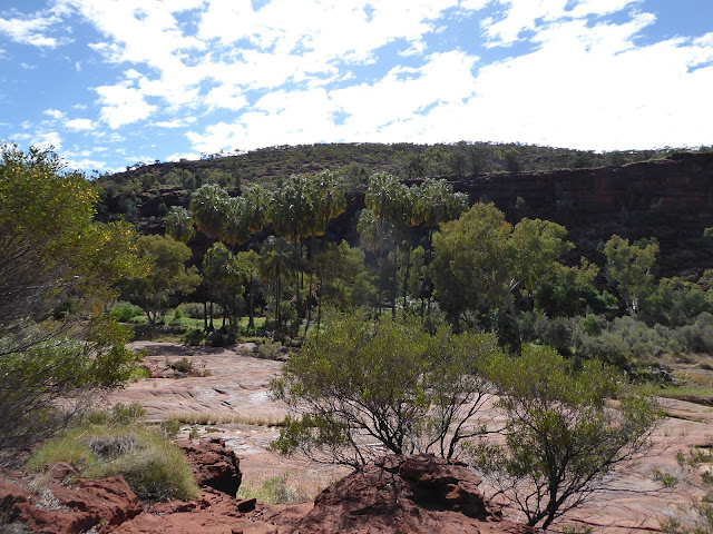
As we drew closer to Palm Valley itself we started to see the palms -tall ones towering over us, and small ones growing in the shelter of the cliff edges.


We enjoyed  the rugged drive into Palm Valley and a walk which should have taken us 2 hours. The stunning views of red cliffs, reflected palms, and water beneath a clear blue sky were enthralling. At one stage we needed to take off shoes and socks to pass across the standing water and continue on our trail. Definitely worth the effort, and it certainly afforded lots of wonderful photo opportunities.


the wading section of the track


Erica, Trevor, Zita,Al, Craig, Evelyn


We had a very cool night , with a clear starry night, but very little sunset. We shared the fire with a mix of Tasmanian, Victorian and South Australians.

My apologies that this blog is short. I've written it three times now, and I've had a minor dummy spit, so you have missed out on some of the initial descriptions. Once you see the photos hopefully all will be clearer.


Day 5 Owen Springs to Palm Valley

Red Centre trip

Day 5

July 25th -149km

We enjoyed our drive through the Owen Springs Reserve, with many vistas of creek bed and red rocky cliffs.

Although there are no facilities it is a really lovely spot to camp.

The startling white of the old homestead ruins against the red of the rock and blue of the sky is incredible. The stories of life back on the station give a real feeling for the change which has occurred in the last year's. Imagine being left for weeks on end with a one year old in an isolated homestead with nothing but a very basic house, and needing to keep water up to the troughs as well as survive with no support. They made them tough in those days.The track through here was pretty good, with a few rocky or sandy s editors, but very well signed with warnings where needed.


We turned on to the Hermannsburg road with the Western Macdonnell in the distance and stopped a a roadside stop with a tank. We filled up our water supply and left a puddle for the finches and bees to enjoy. The finches congregated across the road in a bush and had a noisy debate about whether to come closer while we were there. I tried to catch a shot of the finches, but it wasn't very good.


About another 40 km down a sometimes interesting road we came to the township of Hermannsburg. This old Lutheran Mission town is an interesting spot. The supermarket was inside a shed. We found phone coverage and posted the outstanding blogs which had been waiting, then took a drive around town. Found the old mission area and church but didn't go in. We also saw a house block containing 3 horses, as well as lots of wild horses roaming around the town.


Just out of town is the turnoff to Palm Valley ,and we enjoyed the relatively easy drive in between red cliffs with white trunked gum trees clinging to them and picturesque river beds, and water sitting down at the base, making a truly beautiful picture. we came across an electric grid on the way into the park (something we didn't remember seeing before.

On the side of the road

electric grid


Palm Valley Campground


We stopped on the way in, to climb up to the lookout, and look at the Vista of the many cliffs with green vegetation and creeks between them, and the campsite dotted down below us.


We arrived before the Colwells and Sankauskas, but saved a spot so that we could camp,close,together. The campsite has rudimentary solar showers (cool in the morning and luke warm in the late afternoon) and two fire pits for the campsite, which forces people to share their wood and chat to each other.

Catching up

View from our campsite

The end of the sunset.